
1828, History and Description of the Parochial Chapelry of Saddleworth by James Butterworth, refers to the village of Saddleworth (in the day, commonly called Saddleworth Fold (which is in the historic vicinity of the church)). Saddleworth may be considered as one large valley divided into four ancient boundaries, Quick Mere, Friar’s Mere, Shaw Mere, and Lord’s Mere. Butterworth first makes mention of an ancient road called the Old Roman Road that passes the church of Saddleworth. At the time of writing, it was said that Saddleworth contained no less than 72 distinct villages and hamlets.
The population of Saddleworth increases with the introduction of manufacturers and trade. The population of the chapelry in 1801 was 1065, and in 1811 increased to 12579, swelling to 13902 in 1816.
1851, the population is recorded as 17,999, the total number employed in the woollen industry was 3,438 and in cotton 3,333.
Saddleworth is now made up of independent villages and Uppermill (where the Church is situated), closely neighbours a village called Dobcross and another called Greenfield. Saddleworth has a combined population of 30,755 (2011 Census) one of the larger civil parishes in the UK.
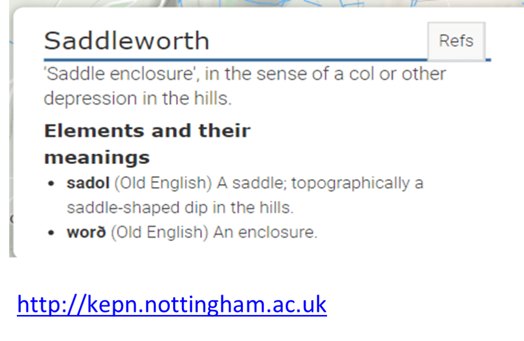
Folk law will tell you that the whole valley was purchased with a Saddle, however Butterworth 1828, says it is most likely to be Sad-del-worth, (Sad) gloomy and dismal, (del) valley and (worth) a Saxon word ‘werth’ part of a parish. Suggesting also, Scaw-del-worth, the woody valley. Although current reference, would indicate something entirely different.
Uppermill which now encloses Saddleworth Church, is named the first village in Saddleworth because of its economy, location, population and other advantages (Butterworth1828). The Church being a focal point for the communities of Saddleworth, a corner stone to its development and growth.